
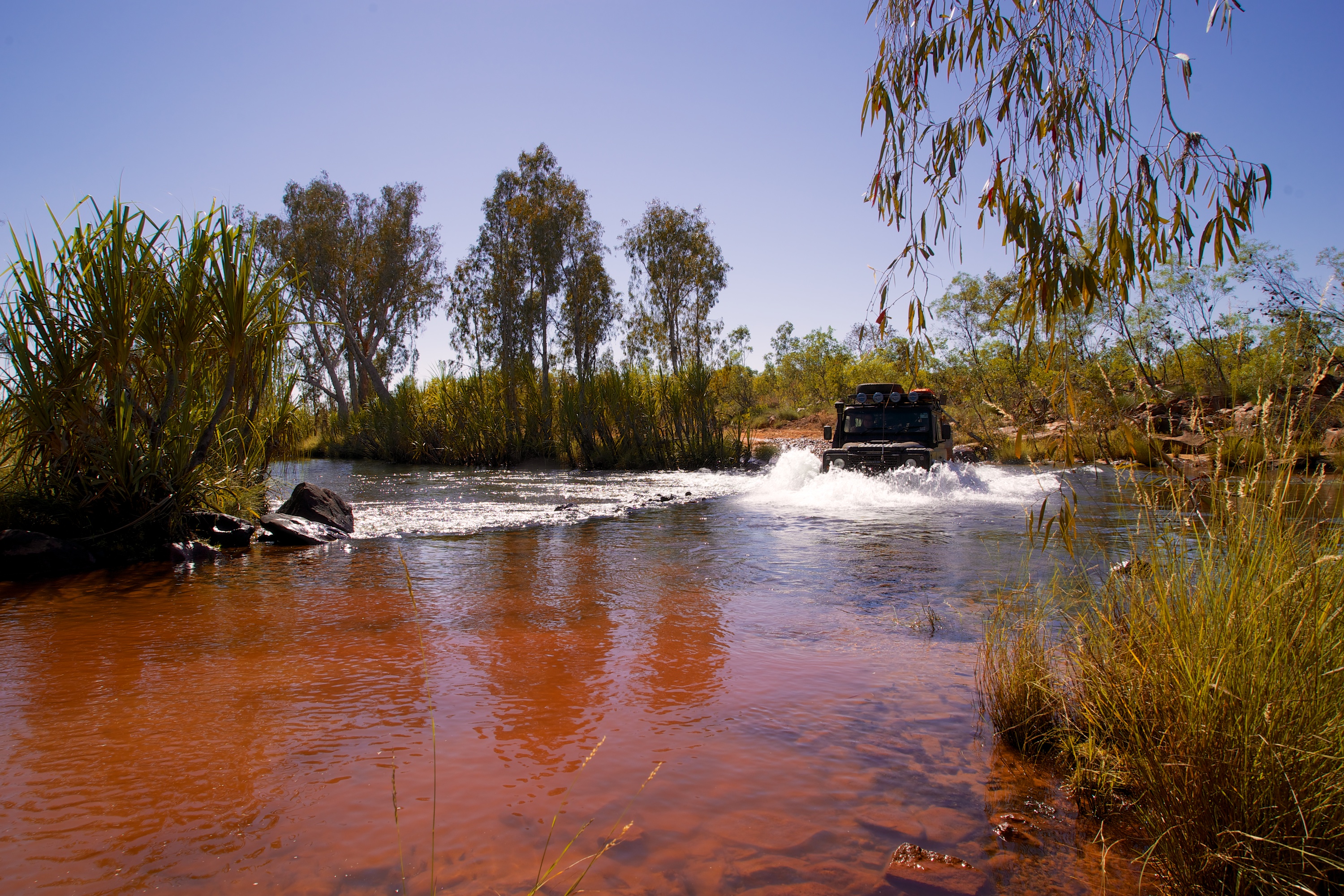
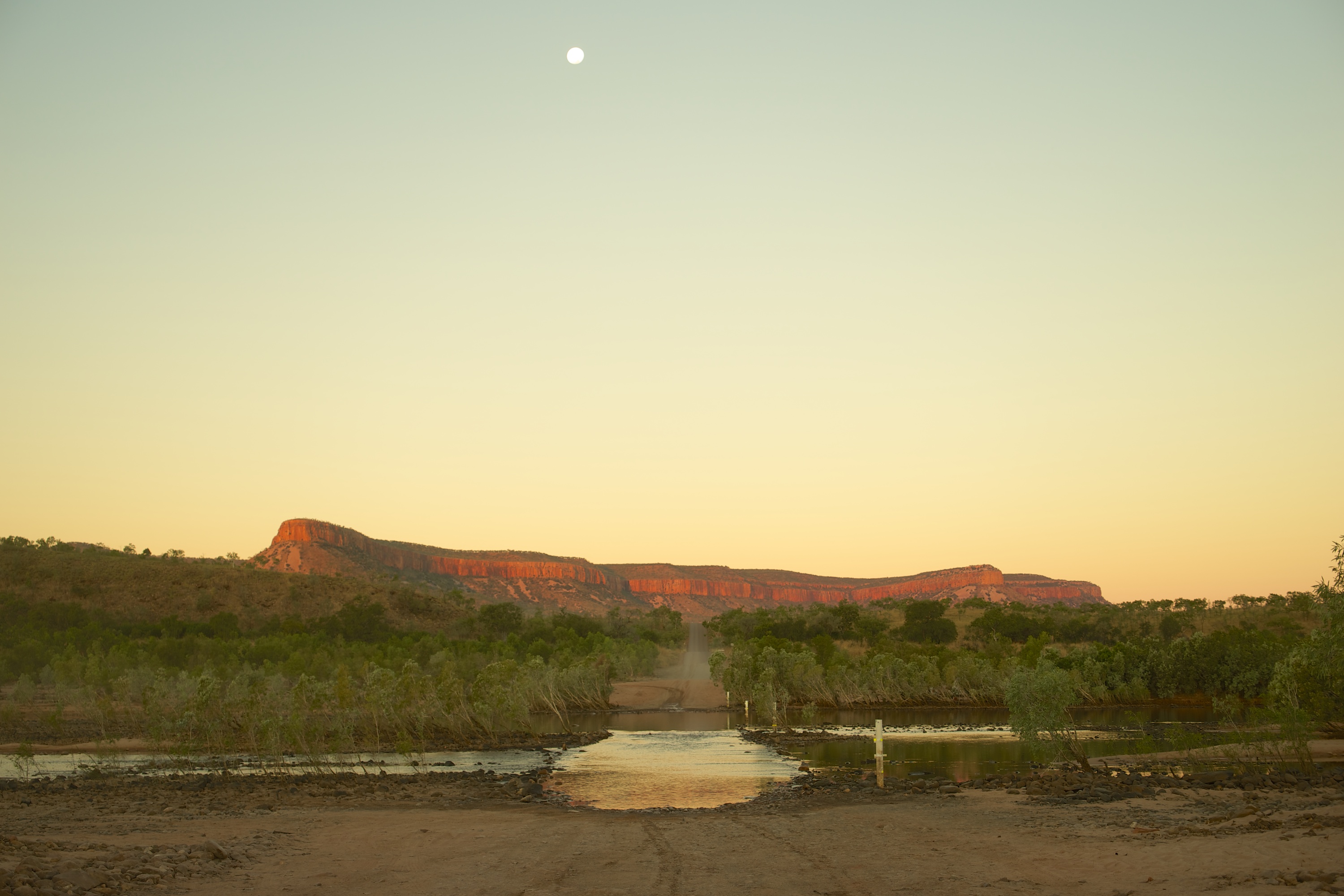
Crossing the King Edward River on our way to Mitchell Plateau
After our expensive fuel stop at the Mt Barnett Roadhouse we turned off the Gibb River Road and headed north up one of the worst roads we have traveled… to the Mitchell Plateau! A feature of the Kimberley is lots of stunning creek and river crossings – some with crocodile warnings!

Seasonal burning has been happening for thousands of years.
The well equipped National Parks camping ground had lots of shady open areas and new hybrid flushing toilets. Some camping areas even had solar hot showers! After setting up our camp and solar panel for a 2 night stay we headed for the 30 minute walk to Little Merton Falls for a spa in the plunge pools above the rapids and then up to the Mitchell River Gorge lookout for a sunset enhanced by the local burning that has been used seasonally for thousands of years by the indigenous peoples to control and promote growth.

Why pay for a spa room when they are free in the Kimberley?
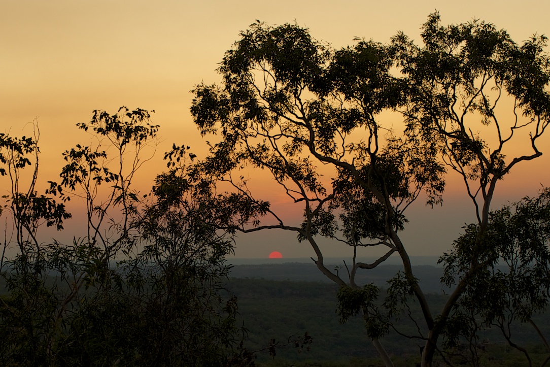
Sunset over the Mitchell Plateau enhanced by the smoke from local burning.
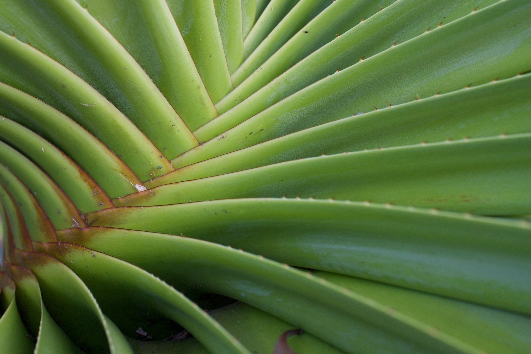
The fronds of the Spiral Pandanus which are very common up here.
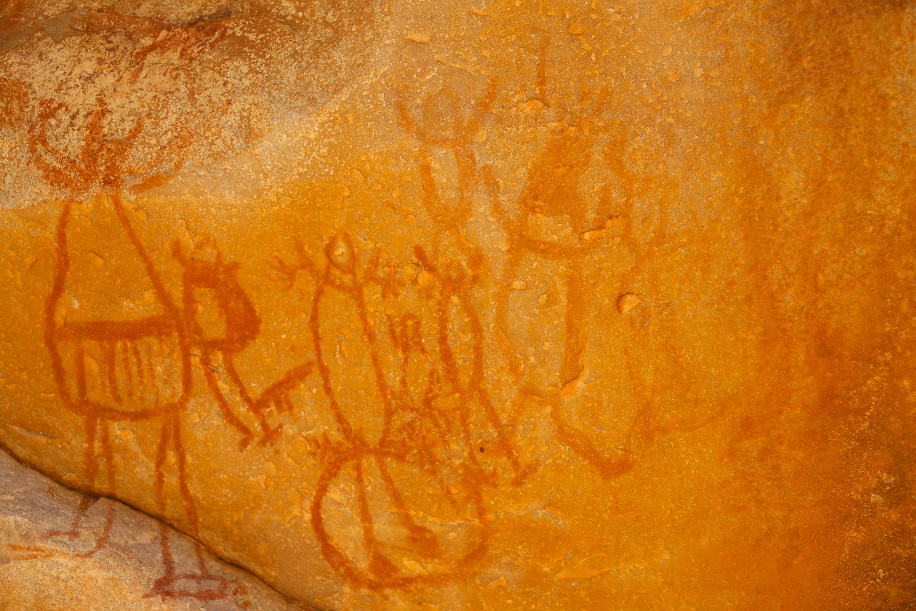
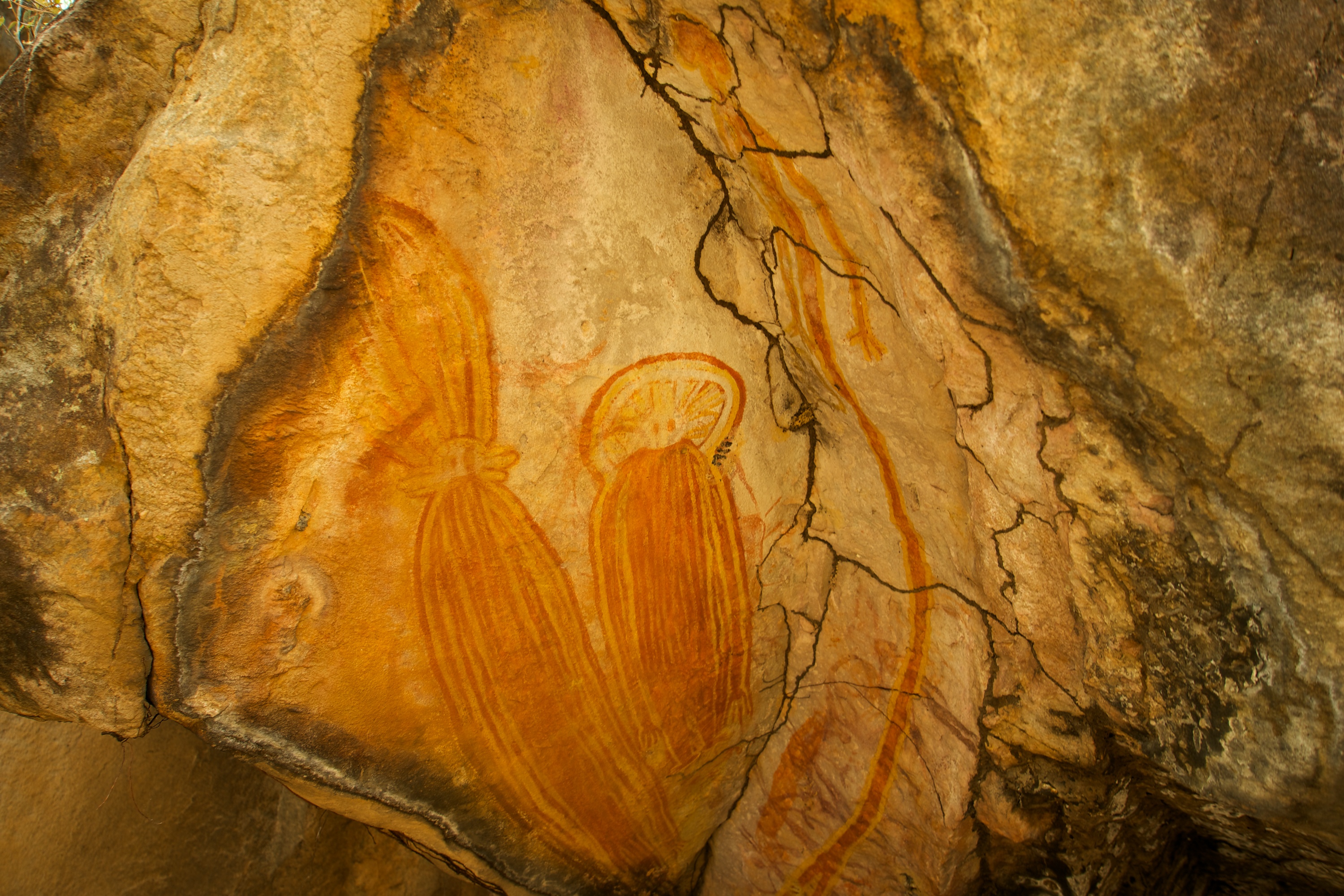
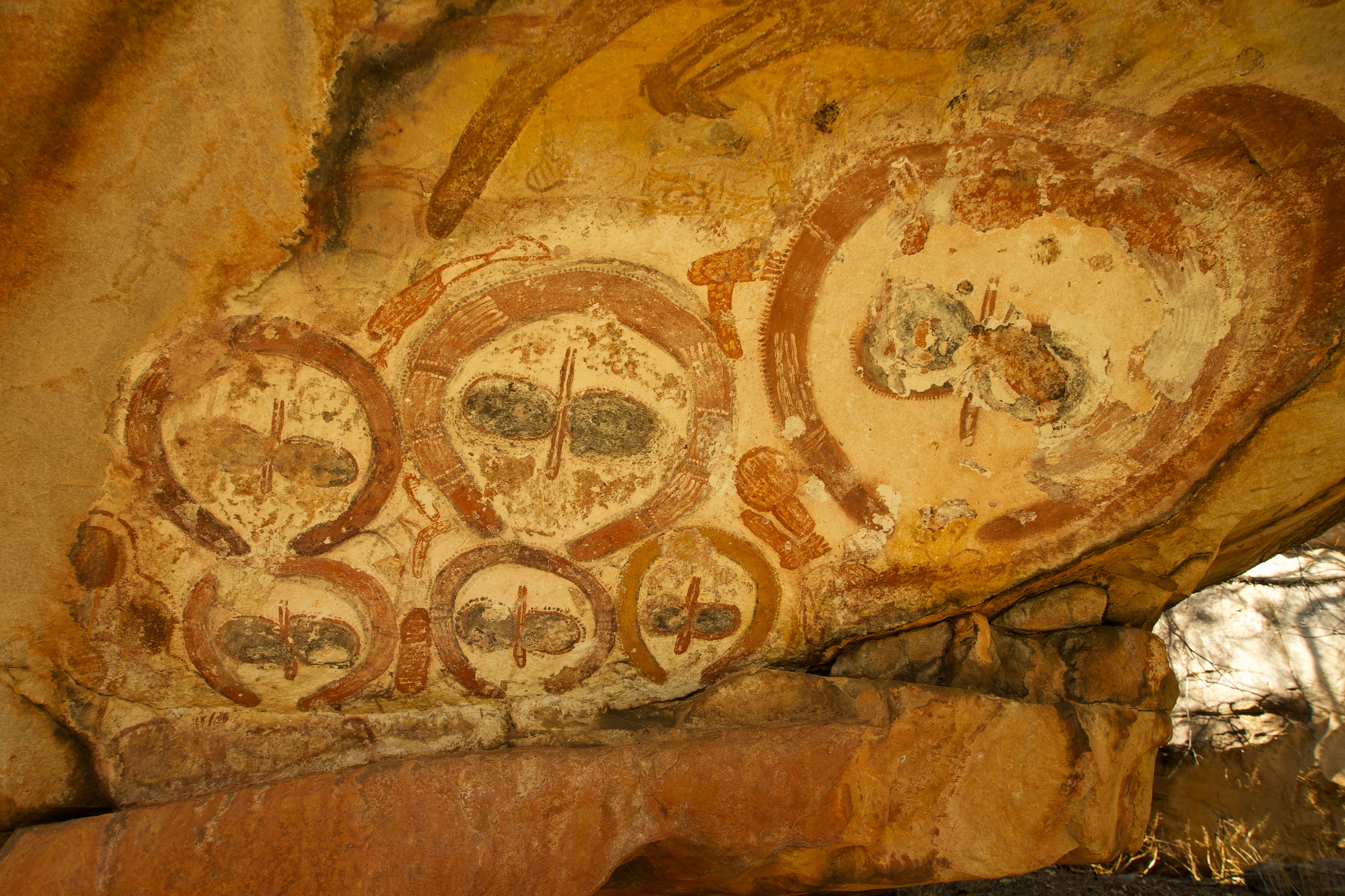
The next day we set off with our packs for a day of hiking and exploring all the way to the fabulous Mitchell Falls. We began in the cool of the morning and enjoyed the rugged 2 hour trek through palm groves, over a huge narrow gorge at Big Merton Falls, the Lily Pad pool, Aboriginal rock art and various interesting trees including a palm that only grows in this region, together with flowers and birds.
The view from the top of Big Merton Gorge took your breath away.

A side lagoon at the top of Big Merton Falls was bursting with water plants.
Looks like a family… I wonder if this is how those silly car stickers were inspired?
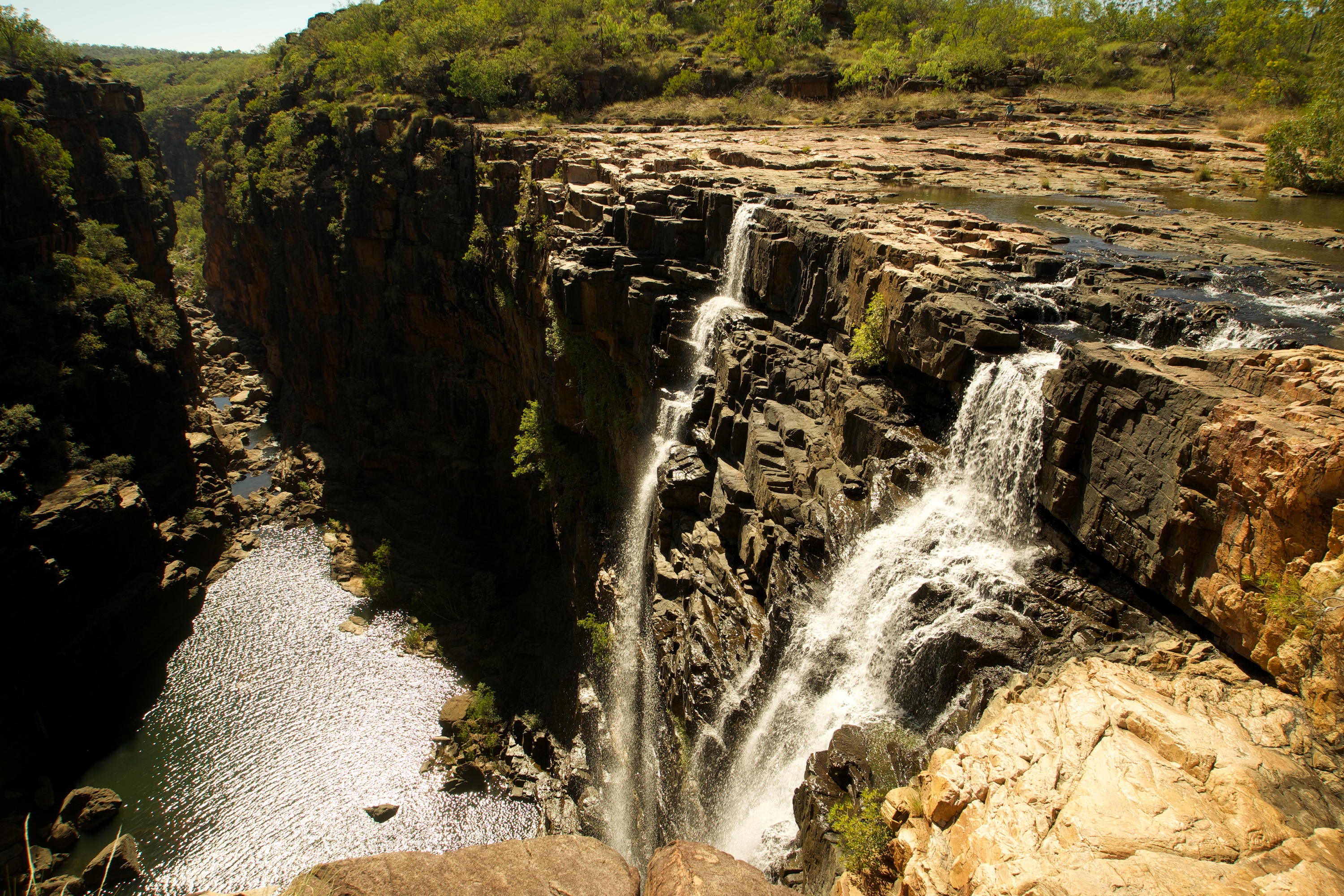
Looking over the top of Mitchell Falls… the sound and the spray were amazing.
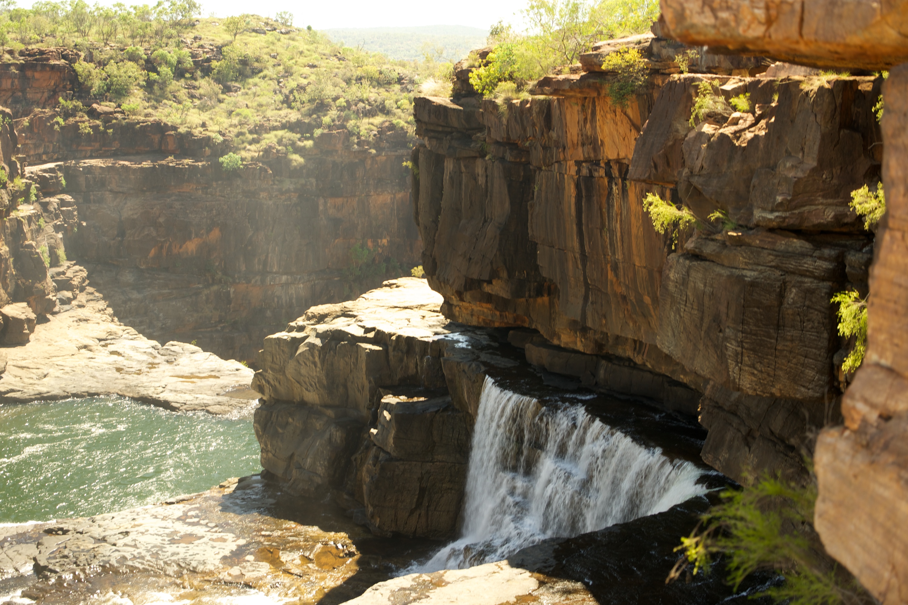
It was well worth the effort to reach the top of the Mitchell Plateau – what an amazing spot. Mitchell Waterfall is a four tiered waterfall with a deep plunge pool at the bottom (in which saltwater crocodiles can be found!) We removed our boots and waded across the river and walked around the gorge for a spectacular view of the spectacular falls.

The four rock ledges of the Mitchell Falls.

This was a nice place to have lunch and relax for a couple of hours 😉
We spent some time swimming in the “spa pools” up the top of the falls (no crocs), eating our picnic lunch and then waited for our “private” helicopter to collect us! Yes that’s right, we experienced our first ever helicopter ride.
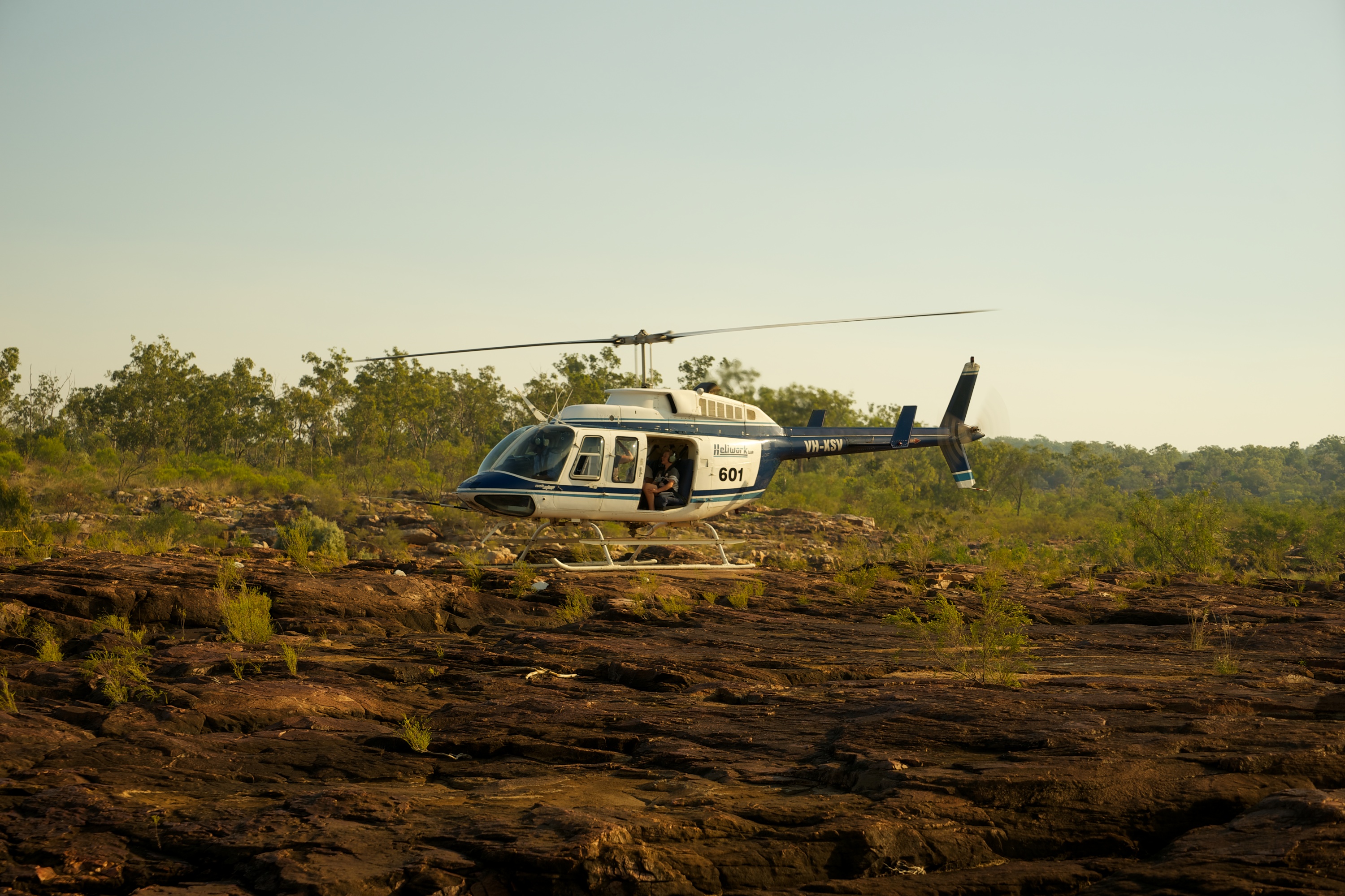
Here come our ride!
We climbed aboard MASH style, taking the necessary precautions to stay well away from the rotors and tail, and sat in our seats with no doors for spectacular aerial views of the falls. Quite a strange feeling to be banking over the falls looking out from your seat with nothing between you and the 700m drop but thin air!
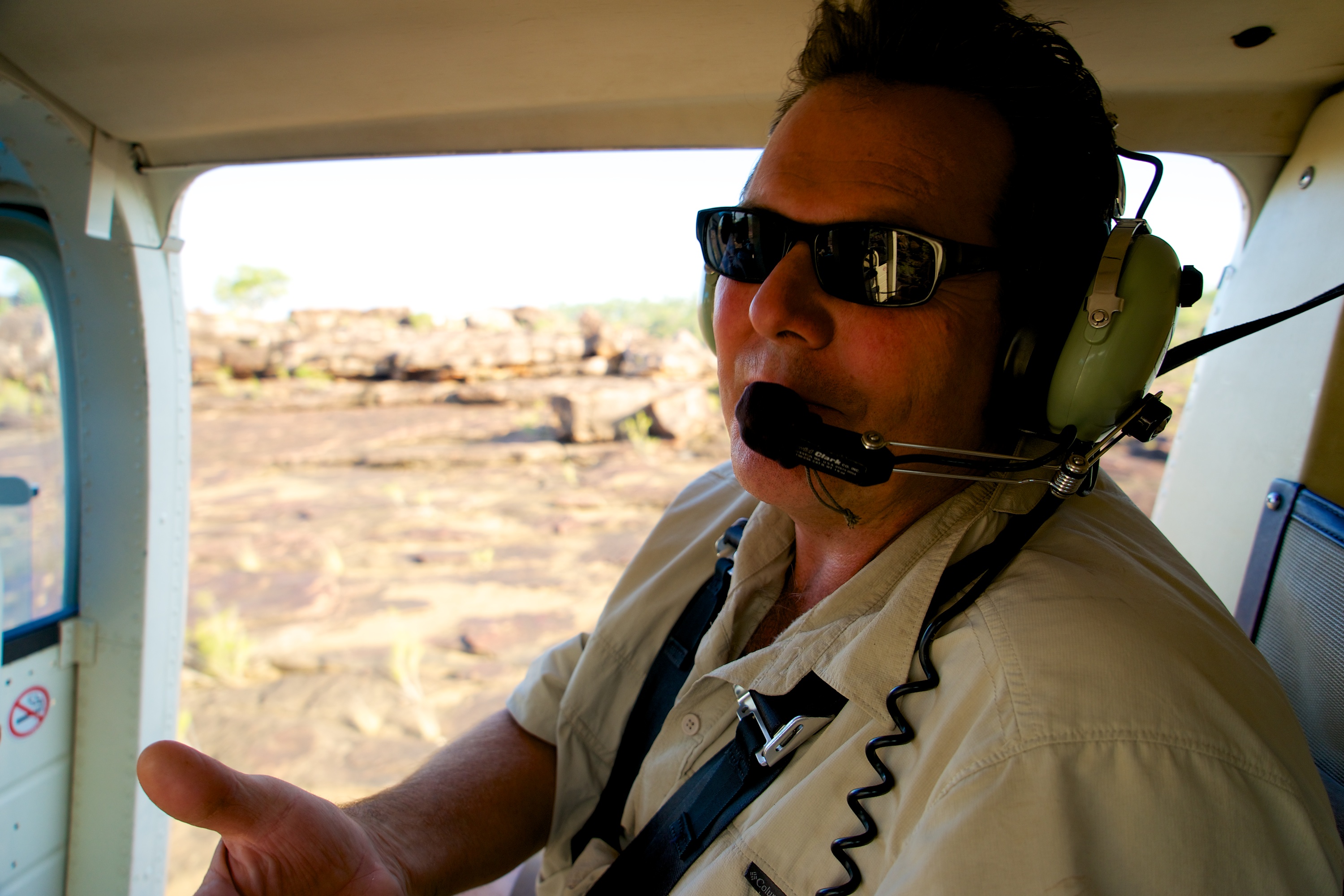
“We are about to take off… give me the damn camera Virginia!”
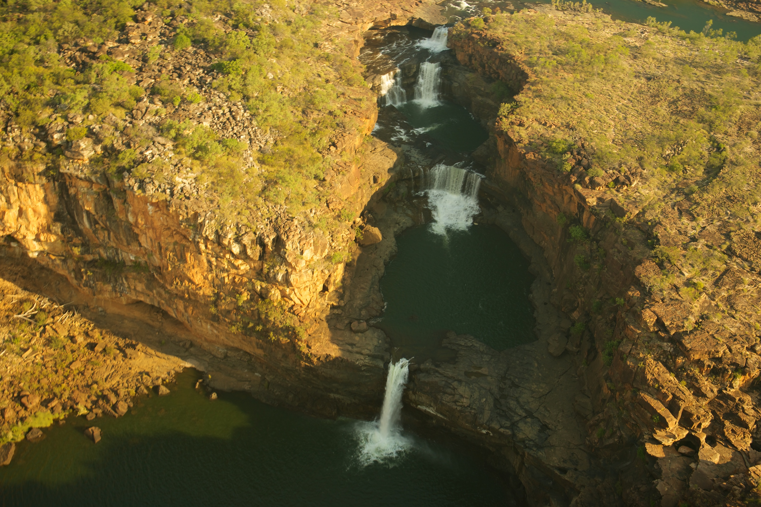
The Falls from the air.
Once back at camp, we couldn’t resist another walk to the Mitchell River Gorge Lookout with our camping neighbours for another beautiful smoke enhanced sunset. (Our neighbours happen to come from Melbourne and we discovered we have mutual friends. It really is a small world).
The next days’ adventure was to trek into even more remote lands. This is a road to do without the trailer. We bounced along a rocky narrow track to a lookout with a fabulous view of the north coast towards Port Warrender. Markus is dead keen to return and get right to water’s edge next time 🙂

Warrender Bay at the very top of Western Australia. Apparently the track in is VERY rough.
We continued along the bumpy track to arrive at Surveyors Pool. Here we found another beautiful waterfall with an amazing plunge pool at the bottom. The creek runs along a rocky surface at the top with many little rapids and pools to enjoy a dip and bubbling spa experience. The water then tumbles over the rocky edge to plummet into the open pool below.
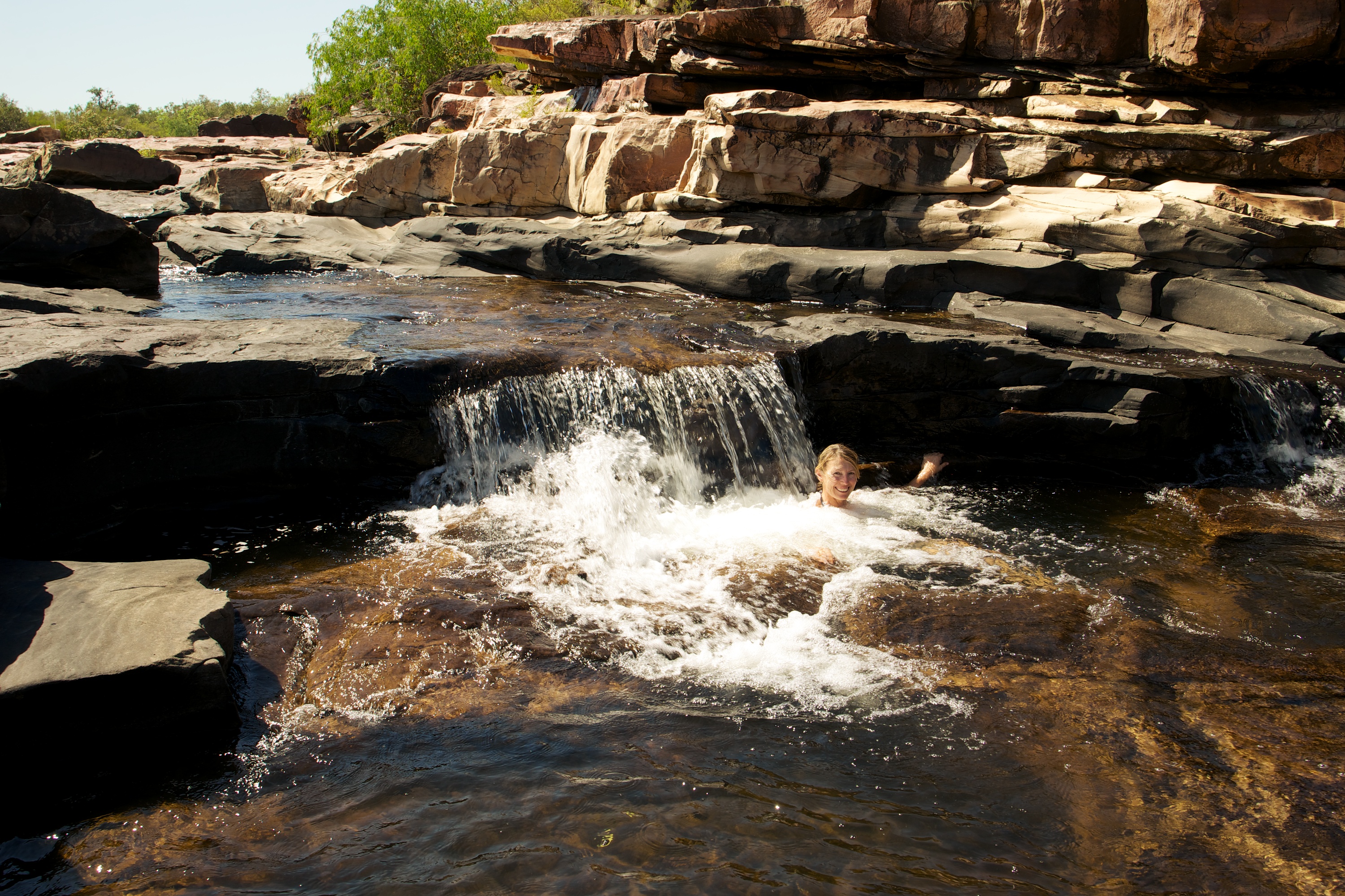
The best way to cool down and wash off the red dust at Surveyor’s Pool.
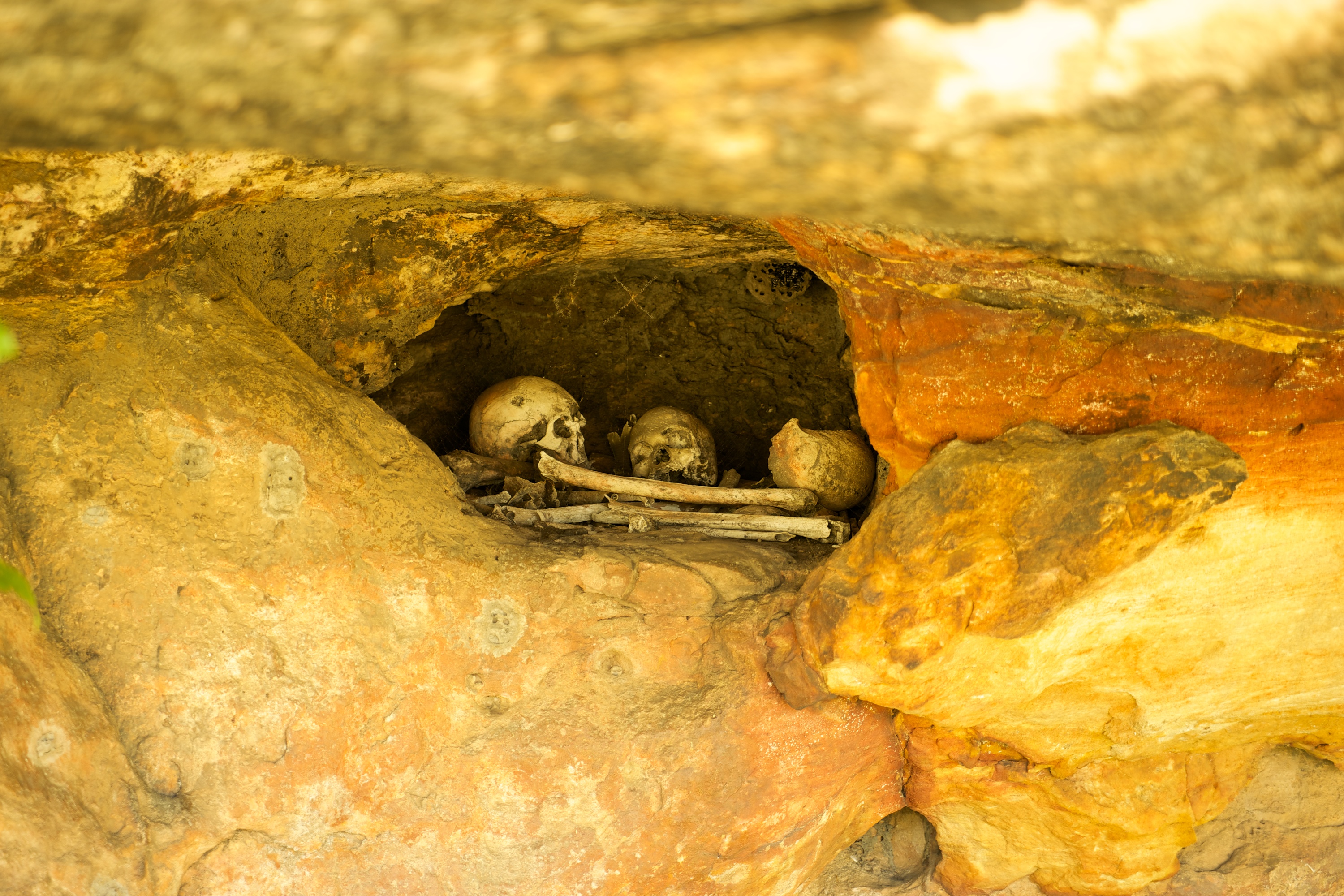
After a swim and taking in the view we returned to our camper and left the Mitchell Plateau to camp at King Edward River. The next morning we spent some time visiting many Aboriginal Art and Burial sites before the long trek east to the amazing Cockburn Range and El Questro Station – more on that next time 🙂
Nearly at El Questro Station… the full moon rises over sunset-lit Cockburn Ranges and the iconic Pentecost River.

WOW! I feel sorry for the people who don’t like calming who miss out on this beautiful country. While your pics are spectacular I know from experience that they will only reflect a portion of the real grandeur. Nothing like standing in those breathtaking places without crowds of people and tickets to enter.
We miss the red dust. As painful as it is when it gets in everywhere- there is something about it – the land that calls you back. Can’t wait to see it oursleves in 2016.
Glad you’re having s fantastic time.
Thanks for that report – great text and photos. We heard all about the Gibb River Road when we were in WA, but with our (then) 200ml clearance and leaf sprung trailer it was out of the question. It’s amazing country. Thanks for clarifying Markus’ clothing options when swimming. Until then, I hadn’t thought of it and now … well, I’ve booked in for hypnotherapy …
I’m lovin your posts and always looking forward to the next one….. Keep them coming, looks like your having a ball. Don’t let the gap between them be too long 🙂